Walk completed August 16, 2014

Friday, August 8, 2014

August 8, 2014 -- Day 54, Sundridge to Dunton Green, 5 miles

Today was an easy day – only five miles – made easier by yesterday’s trail reconnaissance. The distance between Shaw Lodge near Sundridge and Dartford (my next stop) is about 17 miles. Not wanting to walk that far with a very heavy pack (5 pounds heavier than its normal weight due to the addition of the duffel and extra maps I can no longer forward to myself), I tried to find accommodation to cut the distance down. The only place I could find was in Dunton Green, only 5 miles from Shaw Lodge, but it reduces tomorrow’s distance to a more manageable 12 miles.

A steady rain was falling during breakfast, so I deferred by departure until about 10:00, by which time the rain had stopped. Because I was familiar with the trail, I moved along quickly, arriving at Dunton Green in under 2½ hours. My timing couldn’t have been better, because later in the day the rain fell harder than I have seen on this trip. By then, I was sitting in my hotel room.

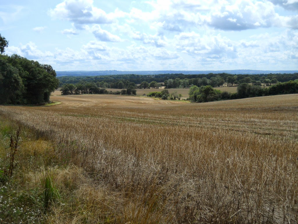
Footpath near Dyrhill


Early on today's walk, I came across an interesting little  plant I've seen occasionally alongside the trials. It reminds me of the snow plants we see in the Sierra in early spring. Fiona, the hostess at Shaw Lodge, had lent me a plant identification book, but it dealt mostly with garden plants, and I couldn't find this one in it. If anybody can identify the plant, please let me know.
 
Mystery plant
 

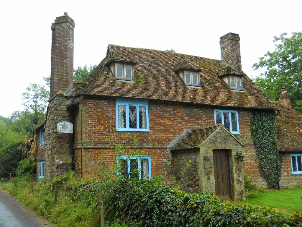
Farmhouse at Dryhill


Near the village of Chipstead, the footpath passed by a lake on whose southern boundary lies the town of Riverhead. That suggests to me that the lake may be the source of the River Darent, although my map shows a little creek running through Brasted (where I had pizza yesterday) before it flows to the river. I’m not sure whether the start of the creek is the source of the River Darent or the lake is the source. Regardless, I’ve been to both, so can claim being at the source.

Source of the River Darent?

Tomorrow will be my final trail walking day, as I follow the Darent Valley Path (and the River Darent) to Dartford. After tomorrow, the walking will be mostly through London and its suburbs, although the towpaths will resume alongside the Thames, as I get closer to Staines.


© 2014 Ken Klug

August 7, 2014 -- Day 53, Dryhill, 8 miles

I’ve been mailing my duffel and maps ahead to various destinations so I wouldn’t be carrying items I don’t need en route. Now that I’m nearing the end of the walk, I can no longer mail those things ahead, so starting tomorrow I’ll be carrying an additional five pounds. In order to ensure that tomorrow’s walk isn’t plagued by the fits and starts I’ve recently experienced, I did a reconnaissance walk to tomorrow’s destination today. The route was clear, and if no trees blow down overnight, I shouldn’t have any difficulty tomorrow.

Surprisingly on a minor footpath, I met two walkers, Kevin and Rob. We had a nice discussion while we walked together for about 15 minutes until they turned off heading to Sundridge, while I continued on past Dryhill to meet up with the A25 road.


Kevin and Rob

After familiarizing myself with tomorrow’s route, I returned by a different route, resulting in an eight-mile loop, all on forested footpaths. Well, I did walk through the villages of Sundridge and Brasted long enough to pass by a restaurant, and have a pizza for lunch.


Yesterday afternoon, a major electronic failure at a relay station in Westerham knocked out all landline phone and internet connections in this area. The provider says it will be 3 to 5 days before service is restored. The lady who runs the B&B is beside herself because she can’t receive phone calls or emails from prospective guests, so my delay in posting today’s walk to the blog is minor in comparison.


© 2014 Ken Klug

Wednesday, August 6, 2014

August 6, 2014 -- Day 52, Toys Hill, 7 miles

It rained heavily last night and well into this morning. By 10:00 am the storm was starting to break up, and by 11:00 the sun was shining through broken clouds. That was the signal for me to once again don my backpack and go for a walk. I knew that pastures and trails with heavy vegetation would still be very wet, so I decided to explore Toys Hill.

Toys Hill comprises 450 acres of woodland under the care of the National Trust. Seven miles of nature trails cross the reserve, along with several dedicated public footpaths that have been around for centuries. Records document that in year 1295 Robert Toys paid 12 pence to the manor of Otford to keep pigs in the woods. For hundreds of years, herdsmen and local villagers grazed livestock there. The recent nature trails complement the historic footpaths, providing a lovely setting for a short day’s walk.

Trig point atop Toys Hill

Memorial bench near site of
former Weardale Manor

Directional road sign

Blue skies again


© 2014 Ken Klug

Tuesday, August 5, 2014

August 5, 2014 -- Day 51, Sevenoaks, 13 miles

I never carry much cash, so I have to replenish it at ATMs fairly often. I was running low, so today Fiona, the hostess at Shaw Lodge B&B, drove me into Sevenoaks where the closest bank is located. I wandered back to Shaw Lodge following the Greensand Way through the villages of Sevenoaks Weald and Ide Hill, and then into Scords Wood, where I walked yesterday. Of the total distance, not more than a mile was along roads.

Today's walk started in Knole Park, a large (about 4 square kilometers) deer park adjacent to Sevenoaks. A large palace (or castle) sits in the center of the park and footpaths radiate away from the castle through rolling hills. I saw a few deer, but they were too distant to photograph.
 
Knole


The Greensand Way is a long distance footpath running through Surrey and Kent, and it passes through Knole Park. (I walked part of the Greensand Way a few days ago near Yalding.) As I neared Sevenoaks Weald, I was taken by the irony of the proximity of a festive sign and a fly tip, not 100 yards apart.


Three fly tips
 

In the same vicinity, there was a lot of farm rubble. But a trailer caught my eye because it had my initials on it -- twice. Maybe I could pull it behind the truck I found  in the weeds last week.


Later, I came upon a relic of a one time residence, but unlike most derelict buildings, aside from the chimney, all traces had been removed.


I met a few dog walkers, and some people at a pub in Sevenoaks Weald where I stopped for lunch, but generally it was a quiet day with lovely scenery and easy walking. I plan to spend the next few days here doing the same thing – strolling through the countryside of Kent, with no particular destination in mind. It doesn’t get any better than this.


© 2014 Ken Klug

Monday, August 4, 2014

August 4, 2014 -- Day 50, Chartwell, 11 miles

Chartwell, the home of former Prime Minister Winston Churchill, is located only a few miles from my B&B, so I decided to tour it today. This area is characterized by gently rolling hills, providing grand views, near and far. Chartwell, itself, is located among the hills, and with its manicured gardens, it’s a beautiful setting to spend a day – or if you are Winston Churchill, a lifetime.


Scords Wood
 

The house is a museum of Churchill family memorabilia, but except for a few WWII items, I was mainly interested in the garden. (Actually, even the garden has a bit of memorabilia – a crater from a German bomb dropped in the winter of 1940-41. It’s not clear that the Germans were trying to bomb the house – there were many bombs dropped in this area as aircraft released unspent ordnance following strategic missions before crossing the channel to return home.)


View from Terrace


The walk to and from Chartwell was also a delight, passing by Emmetts Garden, over Toy’s Hill, and through the hamlet of Puddledock. With names like those, you know you’re in for a treat. As I was returning, I met the first actual walkers I’ve seen in a long time. Sandra and John are from Liverpool. They are visiting their daughter in Tonbridge and may have been lured into the woods by fanciful names as much as I was.

Sandra and John


© 2014 Ken Klug

Sunday, August 3, 2014

August 3, 2014 -- Day 49, Edenbridge to Sundridge, 10 miles


The most direct route from Edenbridge to Sundridge (about 2½ miles west of Sevenoaks) is by road, but you know how I dislike road walking. So to avoid the roads, I cobbled together a route consisting of footpaths shown on my map. I expected some problems and was not disappointed. Several times, footpaths that were on the map were buried under wheat fields. One footpath abruptly ended at a pile of farm rubble, with no way to get around. All of the problems were in the morning, while I still had lots of energy the day was still cool, so I didn’t mind retracing my steps and trying alternate routes. I even laughed at myself as so many false starts reminded me of Shackleton’s several attempts to find a route off the Trident Ridge down to the Crean Glacier. His attempts meant the difference between life and death; mine meant the difference between footpath and road. It’s good to be reminded not to take ourselves too seriously.

 
No footpath on the ground

No footpath through the wheat


The route finding was worth the trouble, because the unfolding scenery was wonderful. You can’t watch scenery when walking on roads and dodging traffic, even if the road isn’t bordered by a hedgerow. On the footpath, you have time to enjoy the scenery, even while looking for holes and roots.


Note lake at distant center.
My footpath passed alongside the lake.


Even footpaths eventually cross roads, and my footpath passed by a pub, about a mile from my destination. Many pubs serve special “Sunday carvery” meals of roast beef, pork, lamb, or chicken with all the “fixin’s,” so I took the opportunity to have my evening meal early, while the sun was shining and I could eat on the patio. There, I met a father and his two sons who were out for a Sunday walk. They had just returned from touring the American southwest – driving from Texas to California.


As I was finishing my meal, a motorcycle gang roared in on their souped-up bikes. I never photographed a motorcycle gang before, and wasn’t going to let this chance slip by.


The footpath continued on through scenic hills as I headed for my B&B.


I wasn't even going to let a bull dampen my spirits, but I assured him I had roast lamb at the pub, just in case.


Reminder: Click on any picture to enlarge.

© 2014 Ken Klug

Saturday, August 2, 2014

August 2, 2014 -- Day 48, Edenbridge (Tonbridge Wells)

I’ll admit to having a certain fondness for trains. (I hope Nora Too! isn’t reading this.) When I awoke this morning to a slight drizzle outside, that sealed my fate for the day. I decided to take the Heritage Diesel Train to Tonbridge Wells and tour the town. Particularly, I wanted to see the high street called The Pantiles – a highly touted block long series of commercial buildings with overhanging eves supported by colonnades on both sides of the street. I can’t tell you how underwhelmed I was.

What did impress me, though was that the street had been converted to a walking mall with sidewalk cafés everywhere. I wasn’t in the mood for shopping, but eating is another story. But first I had to find out what I was looking at.

I went to the tourist information office, and barely caught a walking tour of Tonbridge Wells. The guide was excellent, explaining about the history of the town – which grew up from nothing to become a favorite of royalty and nobility. Everybody who was anybody wanted to be seen in Tonbridge Wells in the 17th, 18th and 19th centuries. There are expensive houses and an old church designed by Christopher Wren. Or maybe it was Wren’s plasterer who hand formed the church’s ceiling. Either Charles something or other or Edward something or other designated the town as “Royal,” one of only three towns in Britain to have such distinction. Originally, people came here to drink and bathe in the iron-rich waters, but now they come to eat at fancy sidewalk cafes like I did.


I telephoned Dr. George and Lady Ann from a sidewalk café, but our call kept getting dropped. I wanted to blame BT Cellnet’s cell phone service, but in a Roayl town, that cannot have been the problem.  Perhaps the problem lies with my 15 year old Motorola Timeport phone.  


Anyway, back at the train station there were gobs of photographers taking pictures of old trains. Along the route, photographers lined up in the fields for a chance to capture history. I took a few pictures of photographers, who seemed more interesting than the trains. Imagine the photographic ruckus that would have ensued had I put my cell phone on display.


Engine with Oast House logo


Nostalgic sign in men's room

Station sign


Nostalgic Poster


© 2014 Ken Klug