Walk completed August 16, 2014

Saturday, July 12, 2014

July 12, 2014 -- Day 27, Kingston near Lewes to Alfriston, 13 miles

Today’s weather forecast was for clear weather, but I knew that before linking up with the South Downs Way, I would have to navigate the same local footpath I used yesterday. The local footpath is bordered by knee-high grass leaning into the path. Yesterday, the tall grass didn’t matter because I was already wet, but today the wet grass would soak me before I even reach the Way. So I needed a better plan. The plan turned out better than I expected.  


My plan was to walk into Lewes (pronounced “Lewis”) following the main road, lightly trafficked on Saturday morning. By the time I reached Lewes, the town was awake, and being a Saturday morning, High Street had been converted to Market Street. I bought a pastry from the bakery booth, and cheese from the cheese booth. Fully supplied for lunch, I attempted alternate transportation plans just in case I get tired of walking. Failing to reach a reasonable deal, I walked to the River Ouse (which flows through town), and followed the river all the way to its intersection with the SDW.

Thomas Paine's home in Lewes

River Ouse in Lewes


Alternatives to boots


The footpath along the river through town was in a park-like setting, but once outside of town, the footpath had all the charm of walking along an irrigation canal – nothing like the picturesque rivers I’ve followed so far. That said, the footpath was dry and flat, and I didn’t even have the usual morning climb up to the downs. In fact, by the time I reached the SDW, the downs had come down to me. (Not to worry, though, there was another climb up the escarpment after I crossed the river.)

 
Chalk cliffs along River Ouse

Heron

Footpath in Lewes


Immediately after joining the SDW and crossing the River Ouse, I was confronted with choosing between a long, hot climb onto the downs or stopping at a café for a break. I called upon all my hiking experience to decide.

The coin landed heads up, so I stopped at the café. While there, I met three folks having lunch. I’m not sure whether I was attracted more to them or their pizzas. Unfortunately, I had to limit myself to soup, because pizza would have finished me for the day.

 
Rosalie, Susan and Ronnie

Rosalie, Susan and Ronnie are from Crowborough, near where I'll be in early August, and Rosalie gave me her number to call when I’m in Edenbridge. She leads hikes in the Ashdown Forest, and has offered to show me around if our schedules work out. I never cease to be amazed by how helpful the local people have been to me over the years. That may be one of the reasons I like coming here.

 I couldn’t delay lunch forever, and eventually had to climb onto the downs. Today was the best day on the downs that I can recall. That may not be saying much, because my recollection is typically faulty, but the weather was sunny and warm, with cool southerly breezes from the channel. The trail was manicured grass, easy on the feet. The views kept improving, although slightly impaired by the humid haze.


I don’t normally get to meet cyclists, because they speed by me faster than I can talk.. Phil and Julie sped by me, but then had the good sense to stop for a snack. Phil recently cycled with a friend 1600 miles on a tandem from Seattle to Los Angeles. Perhaps that explains why he was with Julie today. They are from Tunbridge Wells, close to where I’ll be in early August.

 
Phil and Julie


The downs between Lewes and Alfriston seem to go on and on, offering beautiful scenery the entire way, and the wonderful experience of walking on manicured grass. As you walk, the hills keep rolling on ahead of you, but you don’t really mind the distance because the walk is so delightful. Before you realize, fatigue starts to set in. That’s when I met the four bravest women in the world.


Vicki, Abi, Charlotte and Adele were seated along the path with their four children. Two of the children were eight years old – the others were probably the same age. They had all left Southease (where I had lunch), and were headed to Alfriston, a distance of 6½ miles. Now, I can barely remember having eight-year-olds, but it seems to me that committing to a 6½ mile walk in the wilderness with one eight-year-old is adventurous. Walking with four seems to be tempting fate.

When I came upon them, the kids seemed still full of energy. One of the young girls accompanied me as I passed the group. She did cartwheels on the footpath to show me her athleticism, and when I told her I was from California, she said “I knew it, because you have an American accent.” That started a debate about which of us really had the accent. Before long, a young boy joined us, as the mothers fell behind. Two other kids then caught up, making me feel much like the pied piper. I’m sure that the four mothers could have caught up had they wanted to, but I suspect they were enjoying the free daycare.

My entourage and I eventually walked into Alfriston. I went to my hotel to take a nap. Moms and children are probably turning cartwheels together.


Reminder:  Click on any picture to enlarge

© 2014 Ken Klug


Friday, July 11, 2014

July 11, 2014 -- Day 26, Bramber to Kingston near Lewes, 17.5 miles

Today was to be a long day, so I had an early breakfast at 7:00 am, and was walking by 8:00. I’ve grown accustomed to the long uphill each morning as the escarpment of the downs must be regained. This morning started with blue skies over the valley of the River Adur, but as I climbed ever higher onto the escarpment cold winds from the north increased dramatically. The winds carried with them rain clouds that would reach me at noon.

River Adur in Bramber (tidal)

Footpath ascending the downs
 

In the morning, with the blue sky, the South Downs Way reminded me of the South West Coast Path – constant ups and downs in extremely high winds. When the rain arrived and the temperature dropped, the Way reminded me of the Pennines – without the bogs.

All in all it was a good day to sit by fire with a warm drink and read a book. But, of course, I didn’t have a fire or a book, so I plodded on – and for most of the day I was the only one plodding on. I did find the warm drink, however, at Devil’s Dyke. Devil’s Dyke is a formation formed during the last glacial period – perhaps yesterday, if today’s temperature was any indication. Geologists theorize that glacial melt pooled along the escarpment until it finally broke free and swept away water-logged chalk beneath it, while adjacent chalk was still frozen in place and held its position. Thus, the valley left behind appears more like a river “V” valley than a glacial “U” valley. I found the geologists explanation very interesting, but not as interesting as the hot chocolate I had at the Devil’s Dyke Hotel. Perhaps the geologists can explain why the Devil’s Dyke Hotel is not called the Devil’s Dyke Restaurant – since it serves meals but hasn’t any rooms.

 
Devil's Dyke

When I arrived at Devil’s Dyke, the “hotel’s” car park was full with hang gliding enthusiasts, eager to launch themselves into the fierce north wind. After my hot chocolate, the car park was nearly empty, the enthusiasts apparently deciding that hang gliding in the rain wasn’t nearly as much fun as walking in the rain
 
My camera was safely tucked away in a plastic bag most of the afternoon, but I took it out to document my arrival at Ditchling Beacon, a high point on the path, even though there was no view.
 
Marker at Ditchling Beacon
 
 
The camera came out again when I met Hugo and Georgina, from Winchester, who thought that the day would turn out better than forecast.

 
Hugo and Georgina

About an hour later, a 10-member group calling themselves the Portchester South Downers came along. They are walking the South Downs Way in four days for charity. (For comparison, I am doing it in 8 walking days.) At the time, my feet were tired and wet, and the day was fairly miserable, but they so brightened my spirits that I’m making a contribution to their charity, Rowan’s Hospice, on their behalf. You can too, by going to their website,   https://www.justgiving.com/matthewdbarnes/ 


Reminder: Click on any picture to enlarge

© 2014 Ken Klug

Thursday, July 10, 2014

July 10, 2014 -- Day 25, Amberley to Bramber, 13 miles

I’ve been so busy exploring the past two days (not to mention laundering, blogging, eating and drinking), that I didn’t have time to enjoy the tea room at my B&B. I’ve had breakfast there, of course, but the mornings are too cool to sit outside. Today, as I was getting ready to leave, I noticed that the riverside garden was planted to a tropical motif. Apparently this part of England rivals the tropics for temperature and precipitation. I didn’t see any hula girls, but they were probably preparing a luau in my honor.


Tropical plants

Amberley from South Downs Way
 

Today’s walk started as they all seem to do, with an uphill climb to regain the escarpment that runs along the downs. Everyone was predicting rain today (well, at least the locals were), because a heavy cloud cover hung overhead, and high winds blew from the west. Fortunately, I’m heading east, so generally the wind was at my back. At this point, the South Downs Way is never more than a few miles from the sea (the English Channel) to the south, but the coastal communities were obscured in the darkness.

Grains (wheat and barley) and grasses are farmed on one side of the path, while sheep and cattle graze on the other. Perhaps because it was morning, or perhaps due to the wind, but a herd of cattle I passed had arranged themselves with the calves all hunkered down in a tight group, encircled by grazing cows all facing outward. I don’t believe there are any predators in the downs, but the scene reminded me of pioneers circling the wagons.

 
Cows encircling calves

It’s not very often that locals stop me, but Robin did. He went on to point out landmarks on the horizon, much like a park ranger might do. Robin is from nearby Tillington, and is understandably enthusiastic about sharing the scenery in his own backyard. Thanks, Robin, I do appreciate the tour.

 
Robin

Later, I came upon John and Bob, from Devon and West Sussex, respectively. They described themselves as former Royal Navy buddies, both having enlisted at age 15, having received their commissions together, and having retired together. Now in their upper 70’s (WAY upper 70’s) they’re out walking the South Downs Way together. They pretended to be in a hurry because of the impending rain, but considering the navy yarn they were spinning, I don’t think they were in much of a hurry.

 
John and Bob

Simon and Helen, from Swindon, and I played tortoise and hare most of the morning. I passed them shortly out of Amberley, and they passed me when I stopped to talk with Robin. I passed them again, and they passed me when I was stopped by the Navy. I finally caught them again, and got a photo.

 
Simon and Helen

The South Downs Way seems to have drinking water taps conveniently spaced to allow topping off of water bottles. I don’t recall seeing that on other national trails, but the SDW is the first national bridleway, and perhaps the water is for horses as well as people and dogs. Funny, though, only some of the taps have horse troughs.

 
Water tap (no horse trough)

Due to the limestone base of the downs, there is no standing water. In the mid-1800s, shepherds and ranchers built “dew ponds” with an impermeable lining in order to capture water for the livestock. Over time, other wildlife became dependent upon the water sources, and now the local community is restoring the ponds to benefit the wildlife.


Dew Pond


Stone circles are everywhere in England. Chanctonbury Ring, along the SDW, is an iron-age earthwork that was planted with trees in 1760. Many of the trees were damaged by a storm in 1987, when it was discovered that the Romans built a temple there in the 4th century AD. Presently, it’s a pleasant park, with spectacular views down the escarpment. I didn’t see any stones, but perhaps they were deeper into the woods.


Shortly before leaving the SDW for Bramber (and my hotel), I met Joel, from Brighton, who has been able to take a few days out of a busy schedule to walk a portion of the SDW. Finding a few days for a walk doesn’t seem to be one of my problems, but I’m still working on finding somebody to carry my pack. Are you still reading, Dexter?


Joel


Reminder: Click on any image to enlarge.

© 2014 Ken Klug

Wednesday, July 9, 2014

July 9, 2014 -- Day 24, Amberley, 10 miles

My guidebook describes Amberley as “one of the loveliest of all Sussex villages,” so I booked an extra day here to explore. I'm glad I did, but what might have been considered a rest day turned into a 10-mile stroll, but with a light backpack.

First, I walked to the neighboring hamlet of North Stoke, visited the old church there, and intended to proceed to South Stoke and its 11th century church. Unfortunately, the footpath to South Stoke was quite overgrown with stinging nettles, so I improvised a route to follow the River Arun into Amberley. When I met up with cattle blocking the footpath, I followed Inkpen Andy’s advice and talked calmly to them so they wouldn’t get nervous. I wasn’t nervous, either, because they were cows, not bulls, and they parted and let me have the trail just like they are supposed to do.

 
Church at North Stoke

Former phone booth now an
Information Kiosk

Cattle on footpath by River Arun


Back on the road to Amberley, I met Elena and Kieran, who are leading a group of Duke of Edinburgh Award candidates in hiking and camping exercises along the South Downs Way. (I later met the group in Amberley, but as they are all minors, my custom is not to take their pictures unless their parents are included.)

 
Elena and Kieran

Amberley is indeed a lovely village, with flowers adorning centuries old residences.


A five-minute train ride took me to the neighboring town of Arundel, where I strolled around town, but resisted the castle tour. My experience is that castle tours are best avoided when wearing a large backpack and carrying hiking sticks. (Although I had left much of the weight in my room, I was still carrying a large volume of essentials.) The River Arun is tidal at Arundel, and a large tourist boat gives 2-hour boat tours. Although that prospect interested me, the afternoon was waning, so I skipped that also and headed back to Amberley.

Arundel (note castle in background)

River Arun in Arundel
 
An email from Rupert Grey enlightened me on the derivation of the word “downs:”

[Downs] comes from the dutch duin, or dune.  Here is the etymology - Old English dun "down, moor; height, hill, mountain," from Proto-Germanic *dunaz- (cognates: Middle Dutch dunen "sandy hill," Dutch ruin).


I understand now why I have to climb up the downs.

Reminder: Click on any picture to enlarge.

© 2014 Ken Klug


Tuesday, July 8, 2014

July 8, 2014 -- Day 23, Cocking to Amberley, 13 Miles

I haven’t yet learned the derivation of the word “downs,” as used to describe the terrain here. It seems to me that a better term would be “ups,” because there seem to be more of them. Today started out with a long climb out of Cocking to regain the escarpment. With the hill in front and woodland on either side, the only view was back to the ridge I descended yesterday. It was a good view.

 
11th Century Church in Cocking

View back to yesterday's descent
(through clearing on ridge)


Even that vista disappeared as the footpath entered pleasant woodlands – made more pleasant because they provided a protective canopy against the morning rain. The rain lasted less than an hour, and by the time I left the woodlands, the views opened up again.


I wasn’t the only walker out in the rain today. Heading in my direction were Dexter and Paul. Paul was continuing on gamely after an injury left him unable to carry his pack. Fortunately, Dexter had enough strength for both of them and did the carrying. Paul thought he might recover by tomorrow. But, Dexter, I’m thinking my foot is probably going to hurt tomorrow, so if you’ve got any extra carrying capacity…, well, just a thought.

 
Dexter and Paul

Walking the other direction were Jim, from Chichester, and Mark, from Southampton. Neither of them was deterred by the rain, either. 


The only others I passed were a ewe and her two lambs. They didn’t complain about the rain, and came uncommonly close to me – possibly hoping for treats.


© 2014 Ken Klug

Monday, July 7, 2014

July 7. 2014 -- Day 22, Clanfield to Cocking, 13 miles

The South Downs Way continued its roller coaster wannabe today, but even as it did, the views kept improving. Initially the views were present on hilltops, but eventually the Way reached the escarpment at Harting Down, providing wonderful panoramic views downslope.


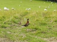
Pheasant


As I neared the halfway point of today’s walk, I spied a bench overlooking the town of South Harting, and decided it would make a wonderful lunch spot. Just downhill from the bench was a film crew (are they still film crews in the digital age?) shooting a scene for what appeared to be a movie. The director issued some commands and the scene was shot. When he said “Cut!” I naturally made inquiry. It seems they were shooting the final scenes for a documentary about the experiences of a local South Harting couple who motored 7,000 miles around India. The documentary is entitled “Grand Trunk Road” and the principals are Rupert and Jan Grey. Click here to see the trailer for their film: Grand Trunk Road


South Harting

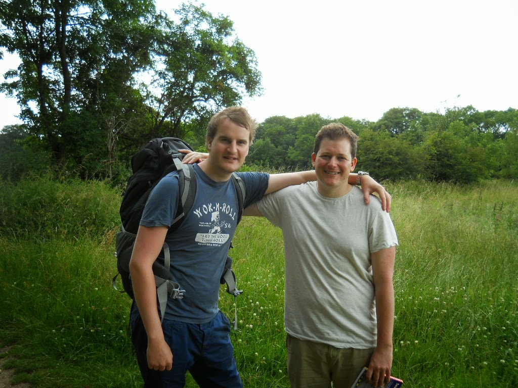
Oliver (Director); Jan and Rupert Grey


While I would have liked to engage them in lengthy dialogue (as I’ve been known to do from time to time), it was obvious that they were on a shooting schedule, and they needed to shoot their scenes as the sun moved out of the clouds. They were kind enough to take time from their schedule for a picture.

 
Approaching Beacon Hill, I met Andy and his Lab, Jamba. Andy lives locally, and is walking to get himself in shape to tackle the South Downs Way. Don’t worry, Andy; the roller coasters will get you into shape in no time.

Andy and Jamba


© 2014 Ken Klug